
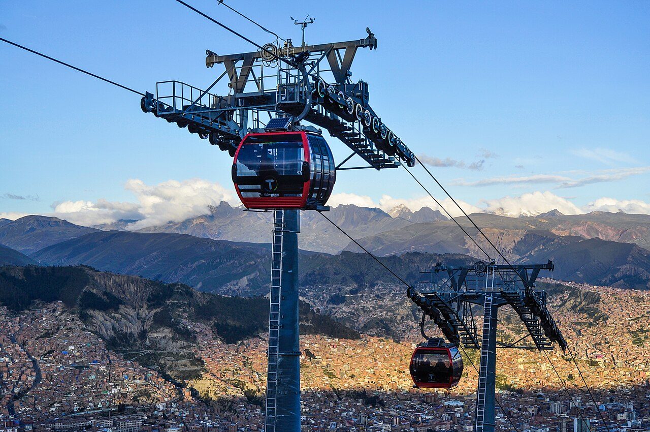
Mi Teleferico
Inaugurated in May 2014 under President Evo Morales, Mi Teleférico shattered the geographical divide between the predominantly Aymara plateau of El Alto and the deep administrative basin of La Paz. Engineered by the Austrian firm Doppelmayr, the system stands as the world’s highest and longest urban cable car network, transforming Andean transit from congested mountain roads to an aerial highway. A web of vibrant, color-coded lines—anchored by the foundational *Línea Roja* and panoramic *Línea Amarilla*—spans over thirty kilometers across the canyon. Tubular steel pylons march up vertiginous cliffs, propelling thousands of glossy cabins beneath the glaciated, triple-peaked crown of Mount Illimani. Inside the gondolas, the chaotic din of diesel engines and street horns instantly drops away into a smooth, wind-swept quiet as passengers climb from 3,640 meters to over 4,000 meters above sea level. Drifting over maze-like brick barrios, laundry-draped rooftops, and the sprawling open-air stalls of El Alto’s 16 de Julio market, riders encounter an intimate, bird’s-eye cross-section of daily Paceño life. As the cabin crests the rim of the Altiplano, crisp mountain air rushes through the ventilation slats, revealing a staggering vista of the city spilling like liquid light into a dramatic geological crater.
More in La Paz
Photo credits (4)
- EEJCC, CC BY-SA 4.0, via Wikimedia Commons
- Unknown author, CC BY-SA 3.0, via Wikimedia Commons
- JERRYE AND ROY KLOTZ MD, CC BY-SA 3.0, via Wikimedia Commons
- Keyan Alejandro, CC BY 4.0, via Wikimedia Commons